20 satellite photos showing how climate change is transforming our planet
Advertisement
There is something wrong with our planet and we experience it every day personally.
The clothes in our closets do not match what is required for external temperatures. Either there is a sudden frost or heat that does not decrease even when it should.
It is clear now that we are referring to climate change that has been going on for many years, but we have only begun to pay the consequences recently. Here is how some places have been altered due to climate change.
via climate.nasa.gov
Advertisement
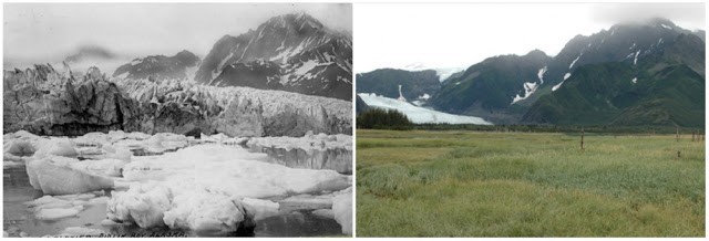
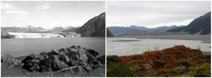
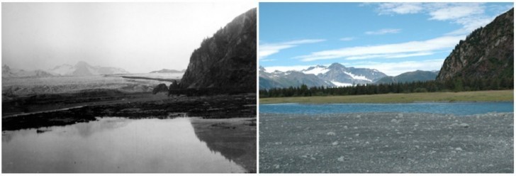
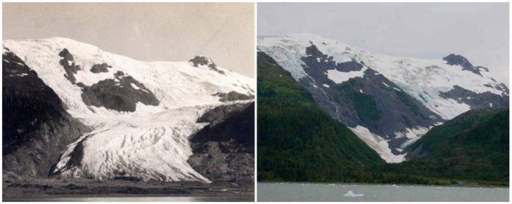
1. Pedersen Glacier in Alaska. Summer 1917 - Summer 2005
Advertisement
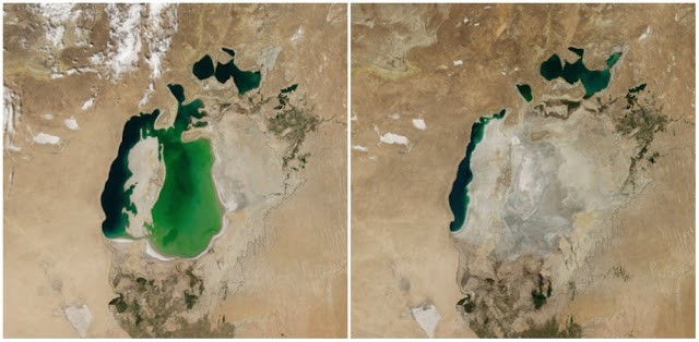
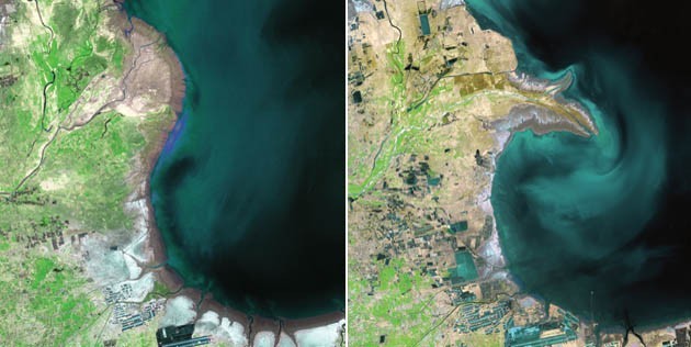
2. Aral Sea in Central Asia. August 2000 - August 2014
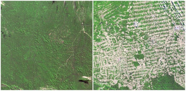
3. A forest in Rondônia, Brazil. June 1975 and August 2009
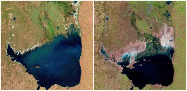
4. Lake Chiquita Lake in Argentina. July 1998 - September 2011
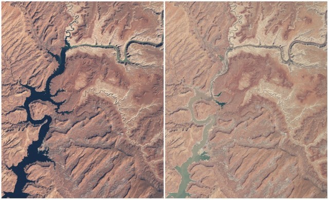
5. Lago Powell in Arizona. 1999 - 2014
Advertisement
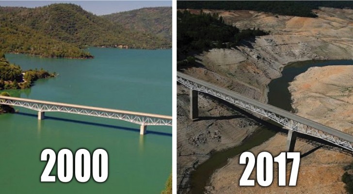
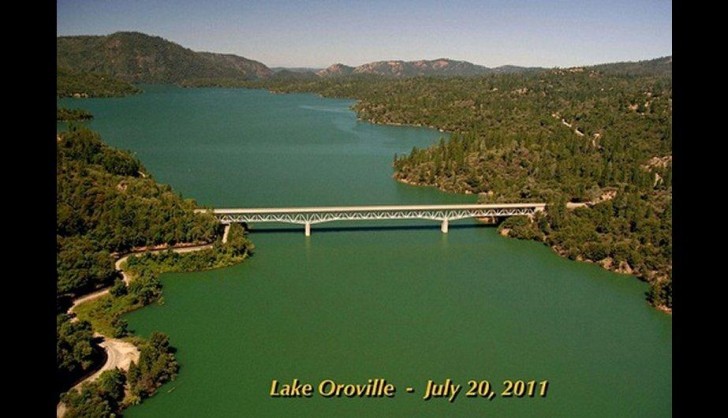
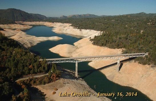
6. Lago Oroville in California. 2011 - 2014
Advertisement
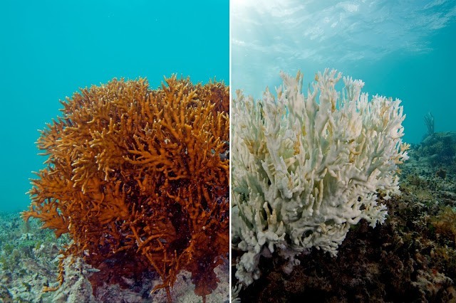
7. Coral reefs --- notice the whitening of the coral.
8. Madagascar Island
Advertisement
9. The melting polar ice caps have made the level of water increase and have submerged areas that were once inhabited.
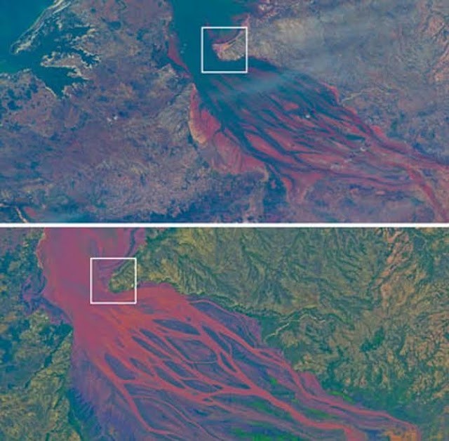
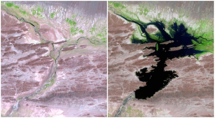
10. Yellow River in China.
Advertisement
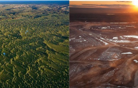
11. Deforestation
12. Carroll Glacier in Alaska. August 1906 - September 2003
Advertisement
13. Bear Glacier in Alaska. July 1909 - August 2005
14. McCarthy Glacier in Alaska. July 1909 - August 2004
Advertisement
15. The River Dasht-e Lut before and after the construction of the Mirani Dam. August 1999 - June 2011.
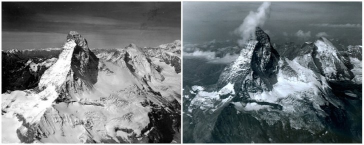
16. Monte Cervino, the Alps on the borders of Switzerland and Italy. August 1960 - August 2005
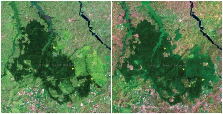
17. The Mabira Forest in Uganda. November 2001 - January 2006
18. Toboggan Glacier in Alaska. June 1909 - September 2000
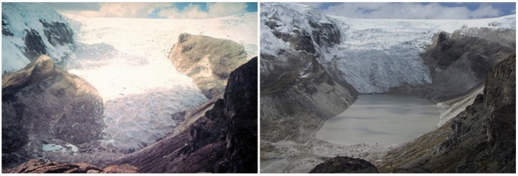
19.The Corey Kalis Glacier in Peru. July 1978 - July 2011
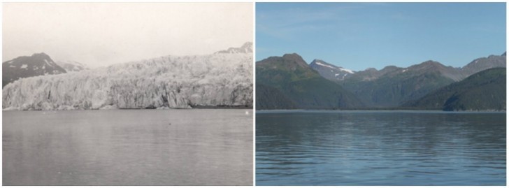
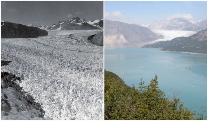
20. Muir Glacier in Alaska. August 1941 - August 2004
Advertisement